
Before taking my vacations and going home, I was thinking to allocate time to the Aral Sea trip during my vacations. Even though I was born and grew up in the region where most part of the Aral Sea is located, I never had a chance to see the Aral Sea. While my parents did have a chance to see the Aral and go there for recreational activities when it was full several decades before, there was not much reason to do so when I grew up as much part of the water had gone far away from its original coastline. The interest for visiting the Aral Sea especially increased after reading a book titled Disaster By Design: The Aral Sea and its Lessons for Sustainability. And a few days after I arrived to Nukus I could find the person who organizes such trips thanks to my friend who gave me contact points. “Jipek Joli” hotel turned out to be organizing such trips on regular basis as most of its residents are foreign tourists who are interested in the Aral Sea.
This post contains lots of pictures I took during my trip to the Aral Sea with the descriptions for some of them.
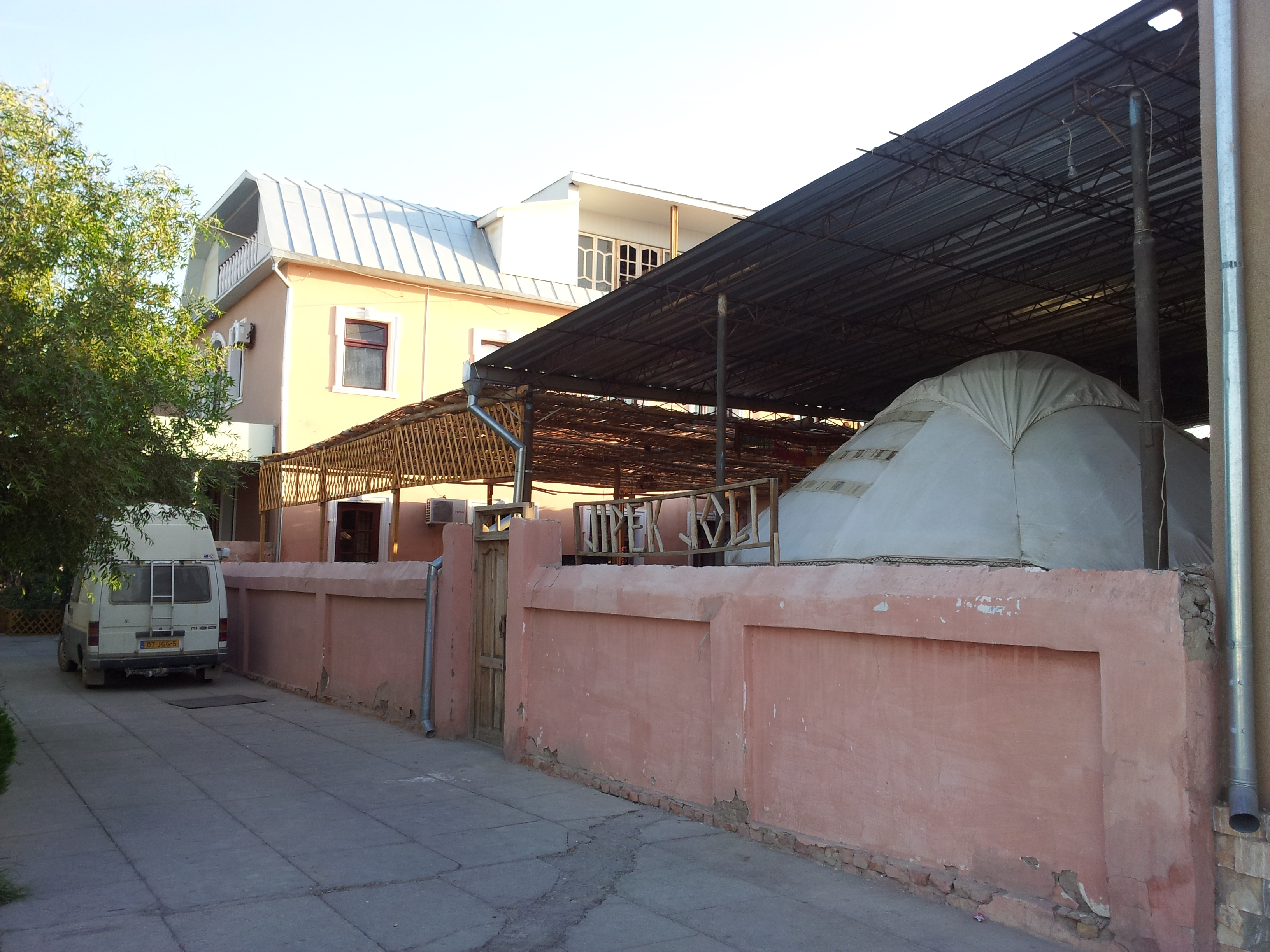
The snapshot of the mentioned hotel from its right corner:
The hotel provided a Toyota Landcruiser with experienced driver who can navigate very well in the Aral Sea area (even without GPS(!)). Our driver had multiple functions: besides actual driving, he was a tour guide and our cook 🙂 I shared this trip with three residents of that hotel, one American and a German couple. In the morning of September 19, we started our trip. It was two day and one night trip and first day agenda was to visit Muynak first and then going to the current shore of south west part of the Aral Sea and stay there overnight. The second day agenda included driving over Ustyurt Plateau, visiting Sudochye Lake and on the way back, visiting Mizdakhan complex.
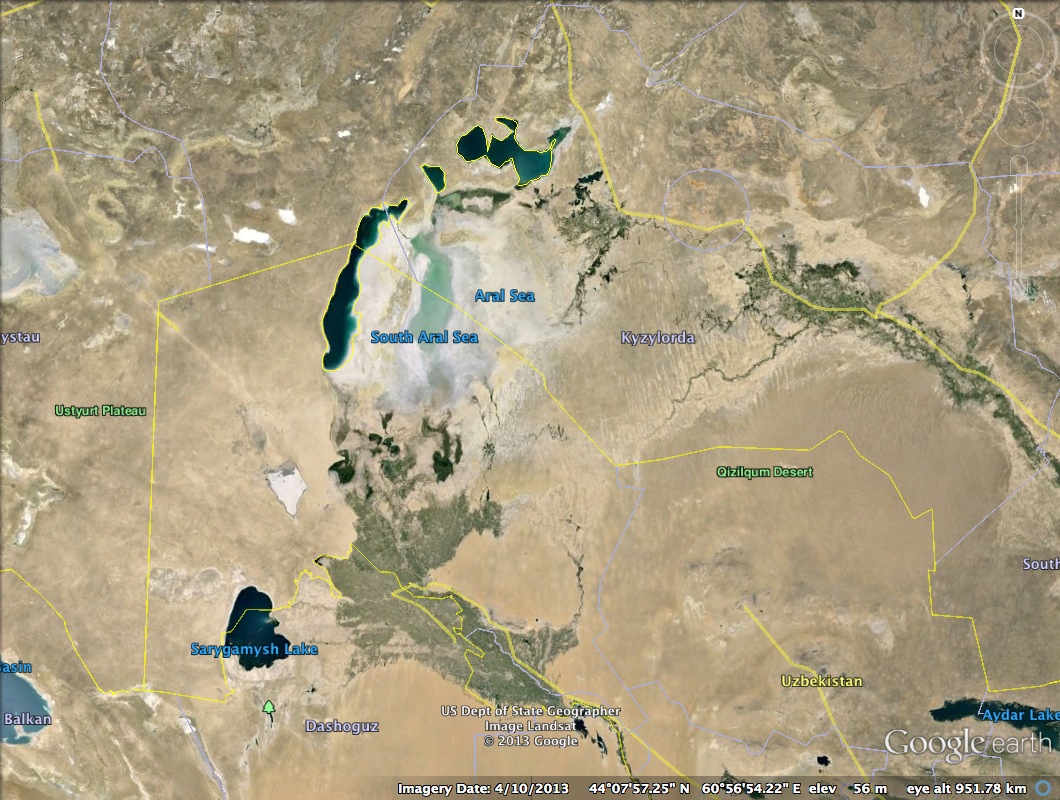
In the below snapshot from Google EarthTM software, we can see the current state of the Aral Sea shot approximately in April 2013:
The destination point for the first day in this trip was the water basin of remaining Aral Sea on the south-western shore.
And here is the slightly magnified image of the above and the approximate route we took for two days (the route might not be that accurate, I draw it just based on my perception):

As we can see from the red path, we went through Kungrad, Muynak and the former shore of Aral to the south-western shore. And on the way back, we drove on the edge of Ustyurt plateau, visited Sudochye Lake and went back through Kungrad to Nukus.
I took several landscape shots on the way to Muynak:


And we can see some houses of Muynak from here:

Some water reservoir near Muynak:

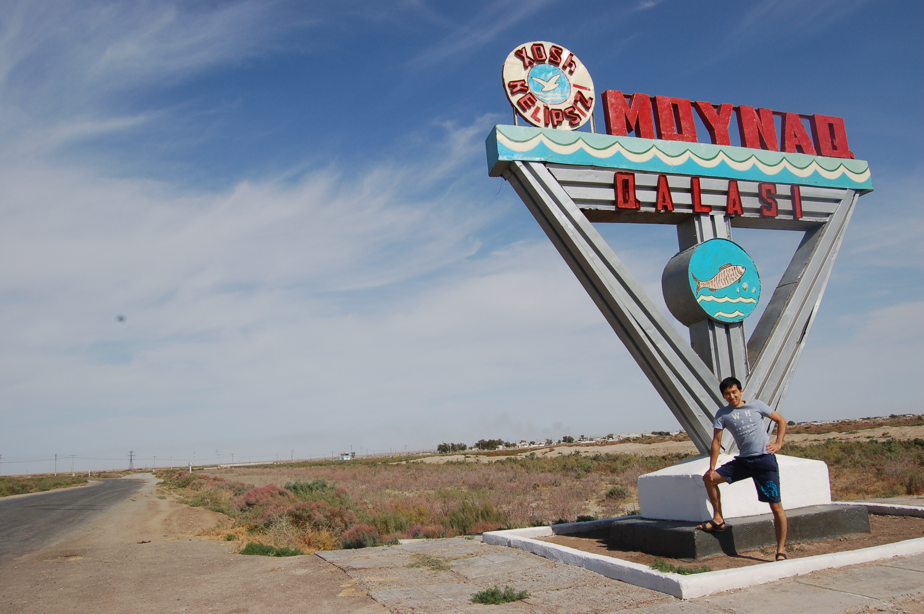
And finally, we entered Muynak. If we pay attention to the entrance sign of Muynak, we can notice several objects. We can see the painting of fish in cylindrical object, possibly symbolising the fish canning factory once flourished here. And we can see the water waves and the sea bird flying over the sea, symbolizing the sea shore once reached here:
In Muynak, we stopped at museum which was located in the center of the city. This shot is the opposite side of the museum, where we can see the symbolic boat on the far right:

The museum is mainly about the fishing industry and canning factory once employing the whole city. We can see the cans of variety of fishes once inhabited in the Aral Sea, before salinity increased to the level that was fatal for the most fish types.

This statue used to stand in front of the canning factory in Muynak:

Aral Sea and Aralkum:

The Aral Sea from the outer space:

The remainings of the ships once floating in the Aral:

The canning factory, view inside, from the historical pictures:


And after ending museum tour, we went to the former coastline in Muynak. It is hard to imagine that water used to reach this place before. Nothing but the desert can be seen in the horizon:

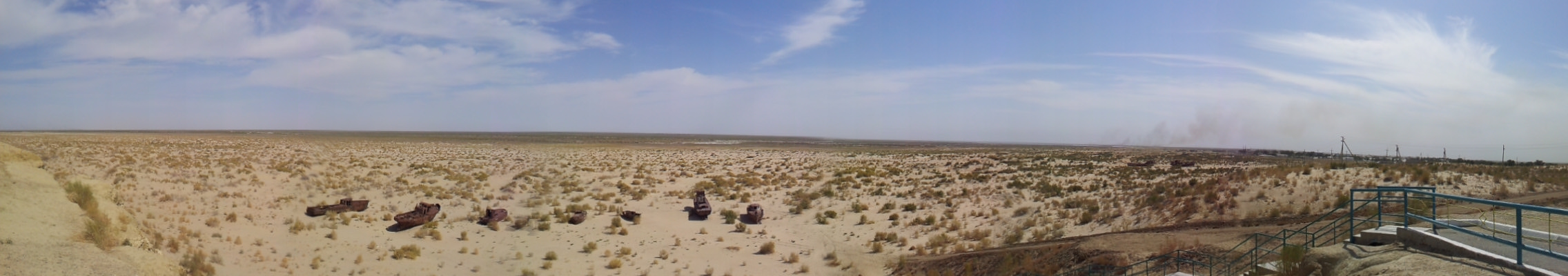
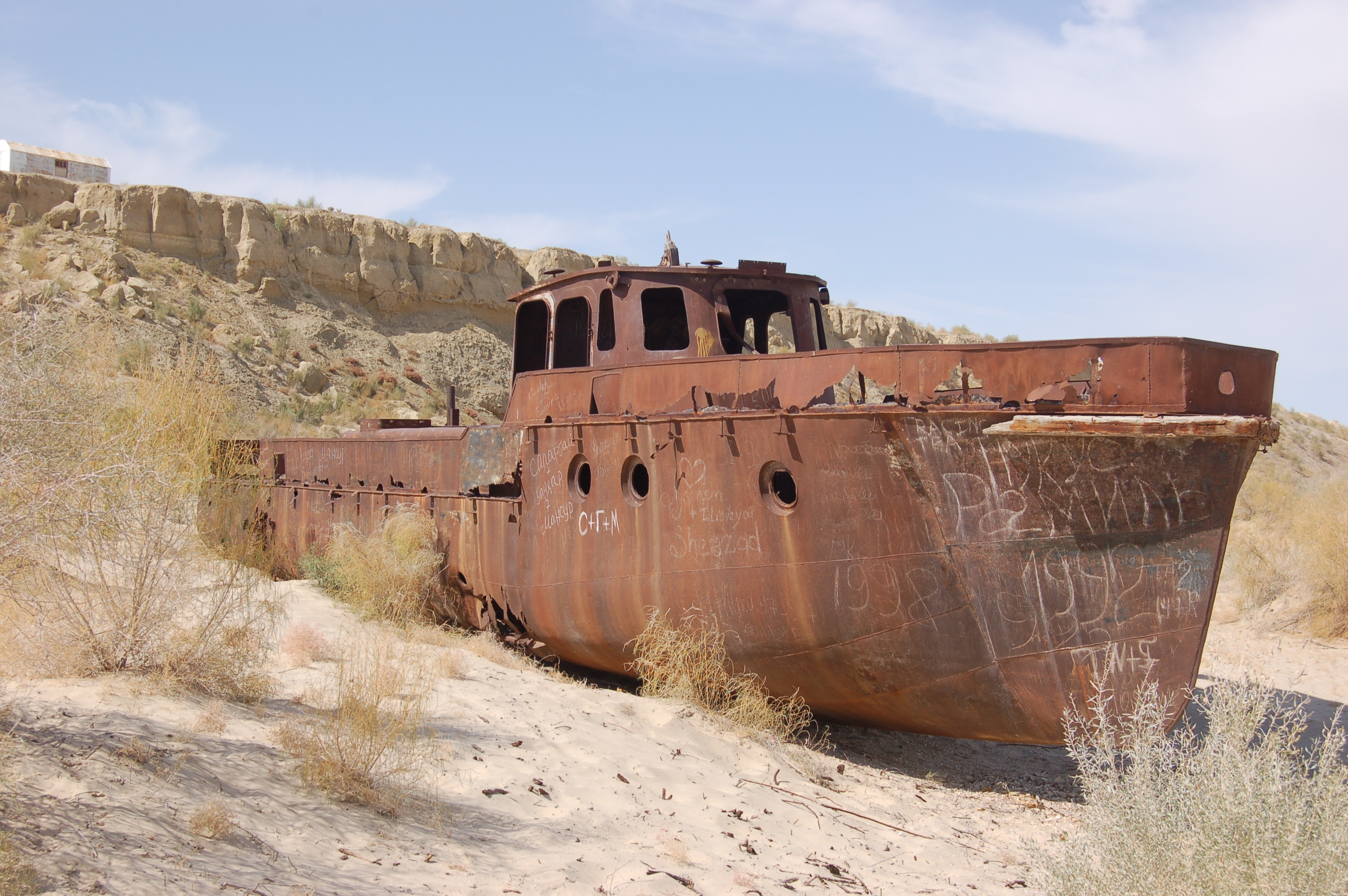
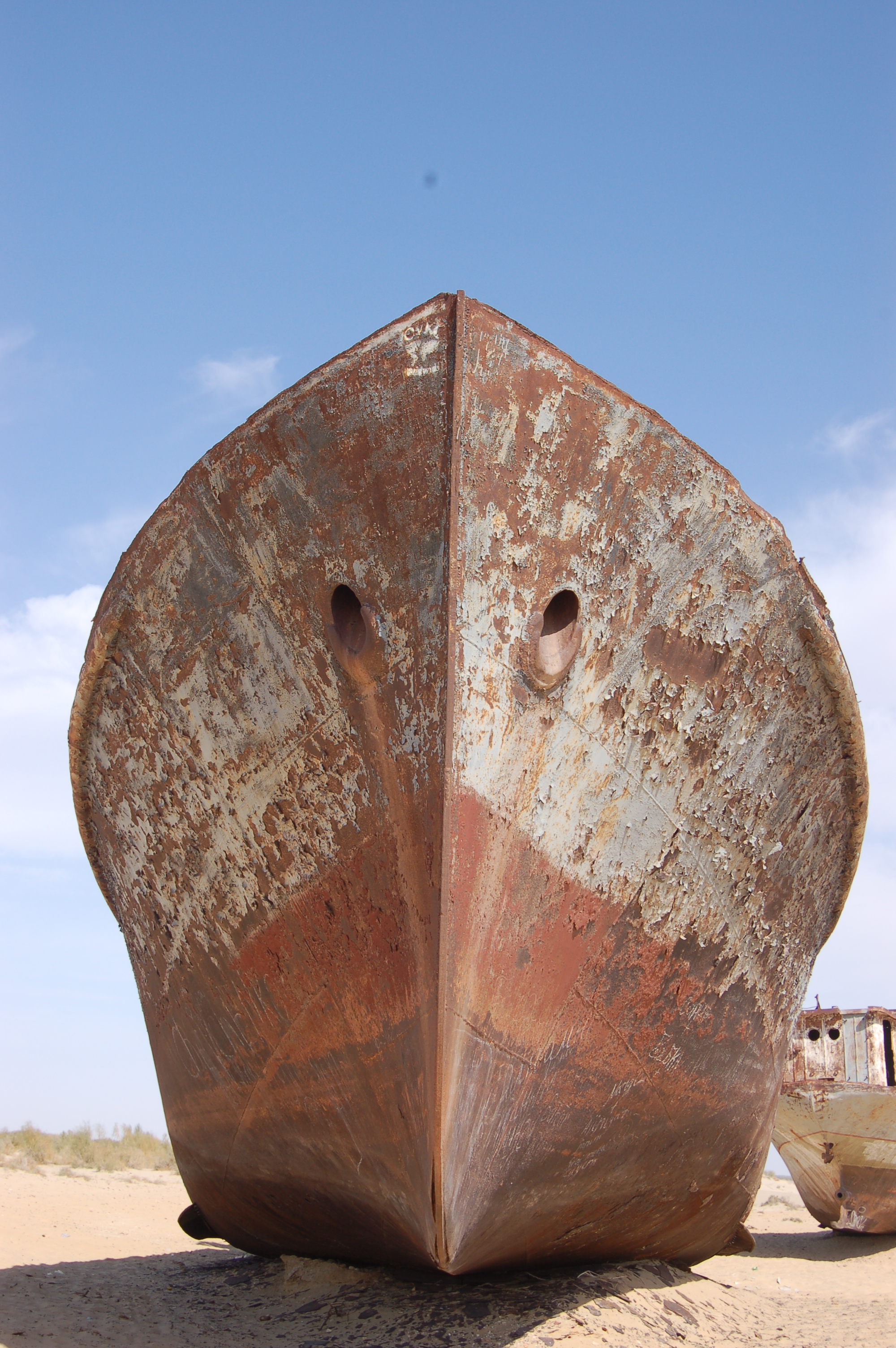
And we come closer and what we see is this. The so-called “cemetery of ships”:

The panoramic view from the high spot:
One very clear evidence that there was a sea once here. It is just amazing to see sea shells on the desert:

And closer view to those rusted ships:


Tourists visited here left some writings, including this in Korean:


Just imagine that you are on the board of this ship, and what you see around is only water:

The cabin of some ship:

and its engines:

And two big ships located close to each other:


After we finished looking around these rusted ships, we went on our trip. Our driver told us that we will pass nearby the canning factory on the way and the other three guys wanted to see that canning factory, but it turns out that for some reasons, the mayor of Muynak (or some other high-rank official) is not fond of curious tourists wandering around canning factory. And we were told that stopping there, coming close and taking some pictures is not good idea, as we might have some troubles with local police. The driver told that he himself ran into troubles in one of his previous trips when he stopped to let the tourists he is guiding to see around. What we could only do was to take some shots while we are passing on the vehicle:


We continued our trip and the way ahead was no longer asphalted road, as we started entering into the former lakebed of Aral. We drove over two line trace left by many vehicles passing in that direction in an massive open area of Aralkum. On our way we saw many natural gas extracting towers, which are called derrick tower. As it was mentioned earlier in the picture titled “Aral Sea and Aralkum”, in the former lakebed of the Aral Sea large deposits of natural gas has been discovered and many foreign oil and gas companies besides local ones are engaged in that project these days. Here are some pictures of such derrick towers:


We have passed different landscapes on our way, some areas containing bushes here and there and other areas where you can’t find anything but plantless plain lands:


It was such a strange feeling. The feeling of absolute silence. In our fast-paced world we are always exposed to some kind of noise, but here there is absolutely nothing around which could produce some sound. Perfect place for obtaining peace of mind 🙂

The green world appear as we come closer to water:

And at last, we reached the destination, here is the blue sea, the south-west point of the Aral Sea:


And here it is, a shot taken from high spot, the beautiful blue water:

This is the end of the part I and I will continue posting other pictures and descriptions on the part II, which will come soon 😉

jaqsi suwretler eken… qayiqqa minipte bir eki jerlerin aliw kerek edi…
Suwdin’ ishbetindema? Qayiq qa’ne taba alsan’ ol jerde endi.
Pingback: Trip to the Aral Sea and around. Part II | Personal Blog of Aziz Murtazaev
Pingback: A Trip to the Aral Sea | Caravanistan
Pingback: Kazakhstan and Uzbekistan: Trip to the Dying Aral Sea · Global Voices